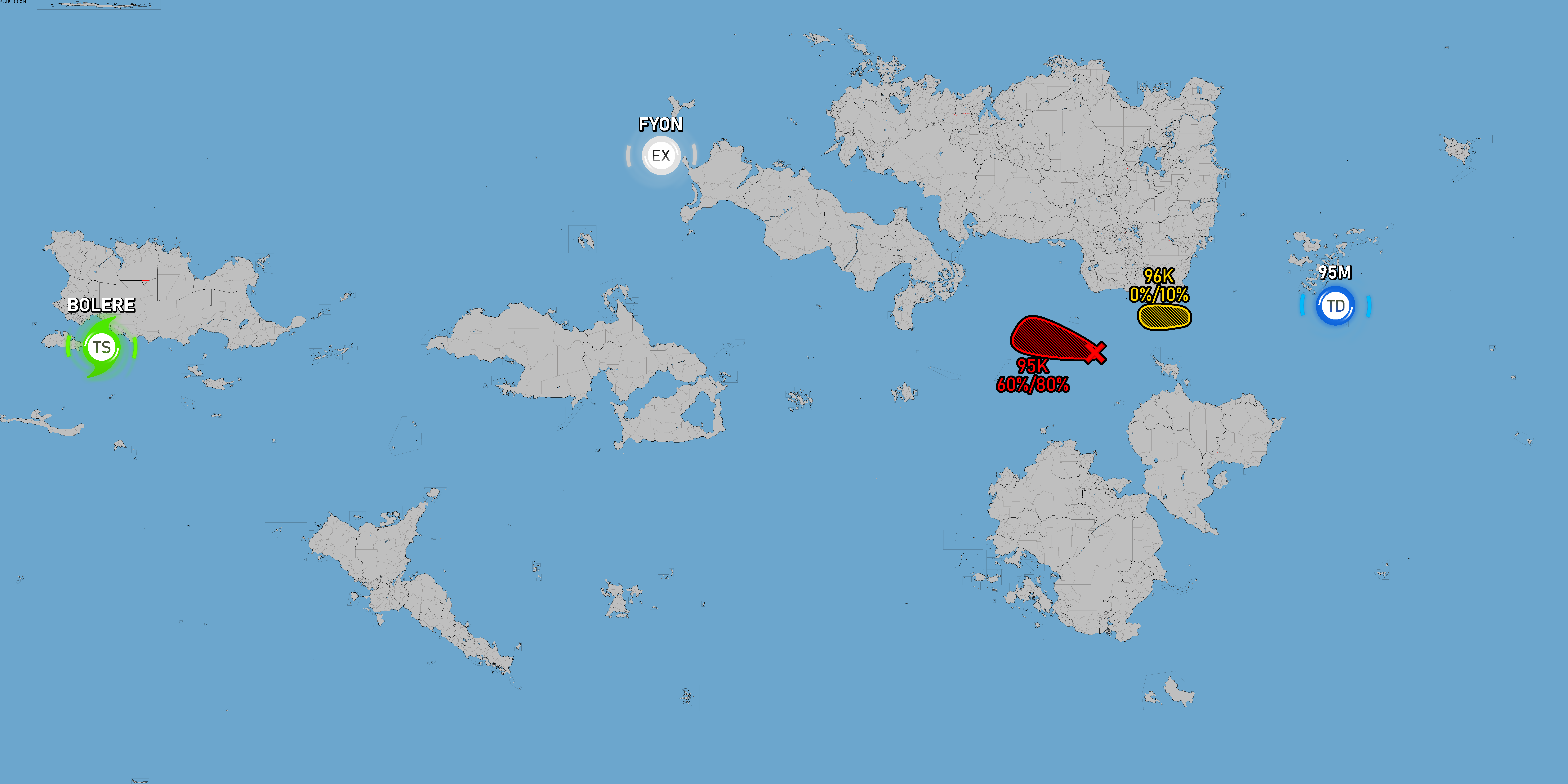
 TROPICAL STORM BOLERE...50/998
 TROPICAL DEPRESSION 95M...30/1004
 EXTRATROPICAL CYCLONE FYON...55/998
 95K...60/80
 96K...0/10
 TROPICAL STORM BOLERE...50/998
 TROPICAL DEPRESSION 95M...30/1004
 EXTRATROPICAL CYCLONE FYON...55/998
 95K...60/80
 96K...0/10
TROPICAL STORM BOLERE
Maximum sustained winds...50 knots
Minimum pressure...998 mb
...BOLERE APPROACHING LAND...
"Bolere is now getting very close to land and its most likely not going to turn around. Many areas are now under a tropical storm warning for tropical-storm force winds and heavy rainfall. Bolere will most likely significantly weaken or entirely dissipate after it passes by, as the dry air is continuing to get more prevalent in the area, as well as land interaction."
No forecast available.
TROPICAL DEPRESSION 95M
Maximum sustained winds...30 knots
Minimum pressure...1004 mb
...95M DESIGNATED AS A TROPICAL DEPRESSION...
...FORECAST TO BRIEFLY IMPACT THE PEKETERI ISLANDS...
"95M has organized quite significantly over the last 24 hours and has been designated as a tropical depression. It is currently expected to become a tropical storm for a short amount of time over the Peketeri islands and soon dissipate as conditions become less favorable."
No forecast available.
EXTRATROPICAL CYCLONE FYON
Maximum sustained winds...55 knots
Minimum pressure...998 mb
...FYON TRANSITIONS INTO AN EXTRATROPICAL CYCLONE...
...THIS IS THE LAST ADVISORY...
"Fyon has transitioned into an extratropical cyclone. This is the last advisory."
No forecast available.
How do the arrow forecasts work?